
Difficult measuring made easy with Moasure ONE
Irrigation and drainage measurements just became simple with Moasure’s patented cutting-edge technology. Save time, money, and hassle with this first-of-its-kind device that draws & measures simultaneously, fitting right in the palm of your hand.
- Automatically draw while you measure
- Generate accurate 3D models of any space
- Rapidly solve irregular perimeters & calculate complex areas
- Measure 3D terrain & calculate volume
- Easily export & share data directly from the app
- No hidden costs or monthly fees
Using Moasure for Irrigation
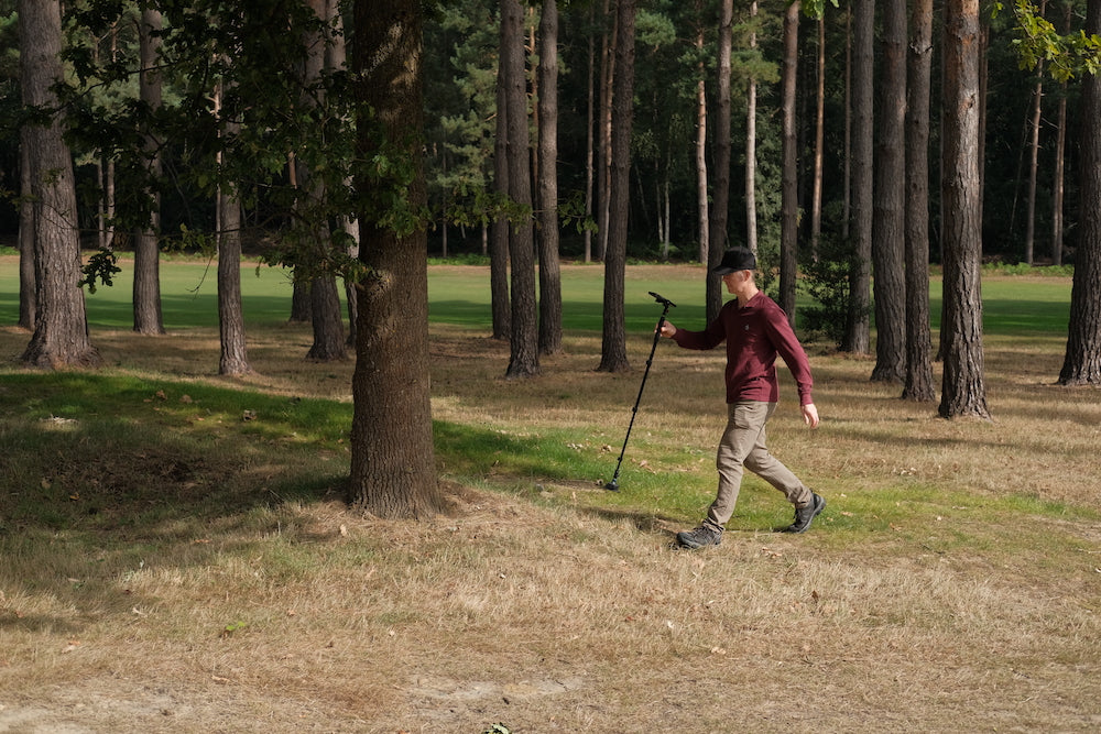
Irrigation and drainage experts are leveraging Moasure ONE for precise measurements of areas and elevations, mapping irrigation and drainage systems, and generating accurate job estimates.
The Moasure app enables you to label essential elements such as drains, taps, and water sources, streamlining your quoting process.
Moasure ONE will become an indispensable measuring tool for any irrigation specialist. From calculating areas, perimeters and distances to factoring in elevations, this revolutionary device ensures efficiency and removes the guesswork from your measurements. With our NEW Volume Update, measuring areas for ditches is made simple. Embrace the future of measuring with Moasure ONE.
Featured Irrigation Software Partners
Land F/X optimizes CAD and 3D platforms for landscape and irrigation design, including the ability to import accurate CSV and DXF data from your Moasure ONE.

Pro Contractor Studio allows you to import DXF files from your Moasure ONE measurements and immediately start designing.
Innovative measuring technology that helps increase efficiency on your irrigation & drainage projects

Improved accuracy
No more guessing, Moasure ONE allows you to be more accurate with your measurements.

Quote more projects
The time you’ll save on quoting for jobs means you can get more done than ever before.

Increase profits
With improved efficiency, you’ll save time and money on everything you do.
Hear from an irrigation specialist
Matthew Atkinson from Hydro Wick in Canada gives us an insight into how he uses Moasure ONE for irrigation projects.
Testimonials from irrigation and drainage specialists
As a golf course superintendent, Moasure ONE gave me the ability to get the exact acreage of all my golf course playing surfaces, making it easier to purchase and calibrate all of my plant protection products for the year. It also is a fantastic tool to help with course design, mapping of irrigation and drainage, renovation project presentation, and interior measurements of all buildings. I am super happy with my choice to give Moasure ONE a chance to impress me!
Jeffrey Swanson
Connecticut, USA
I bought a Moasure about a month ago and I love it. I measure whole yards using the layers and as long as you are very careful with using the Moasure the layers line up nicely and I can load each layer into my irrigation design software. There are a few things that can be improved but I have no doubt they will because the customer support is great to work with!
Kenneth Noll
Florida, USA

Own an irrigation installation/ maintenance business and was looking at options to speed up the design process. Heard about this product, read reviews, asked questions in forums and was still a bit hesitant due to some guys saying it was difficult and a lot saying it was difficult to start with but if you persevered, learnt properly how it worked, then it was the greatest thing. Finally bit the bullet and purchased it and it's brilliant! Still a lot to learn but already it has saved me hours of manual measuring. Lots of videos to teach you and service is good too.
Abby
Cromwell, NZ
Upgrade your toolbox with Moasure ONE today
As seen in the media


How Moasure ONE can help you
Moasure's capabilities have revolutionized how the irrigation and drainage industries measure. Here is a detailed overview of Moasure ONE's features.
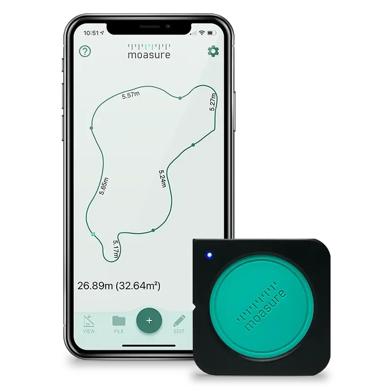
Measure & draw simultaneously
Measure and draw at the same time, capturing elevation changes as you go. All in a fraction of the time it used to take.
No more wasting time transforming scribbled measurements into drawings, Moasure does it all for you as you go. Moasure makes light work of measuring large or small complex areas – accurately capturing measurement data and plotting a diagram as you move around. Review your measurements on your smartphone or tablet all in real time.
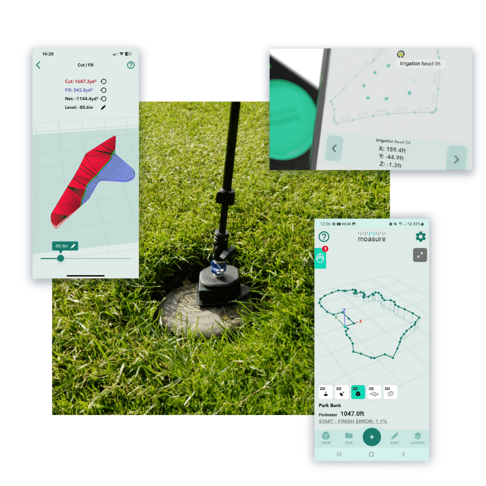
Calculate elevation changes as you move
Moasure captures three dimensional spaces with ease and allows you to review them on screen. It’s easy to calculate the gradient, rise and run or height difference between any two points.
From measuring complex shapes like sloped lawns or steps, to calculating rise and run or assisting with topographical and flood surveys – difficult measuring is made easy with Moasure.
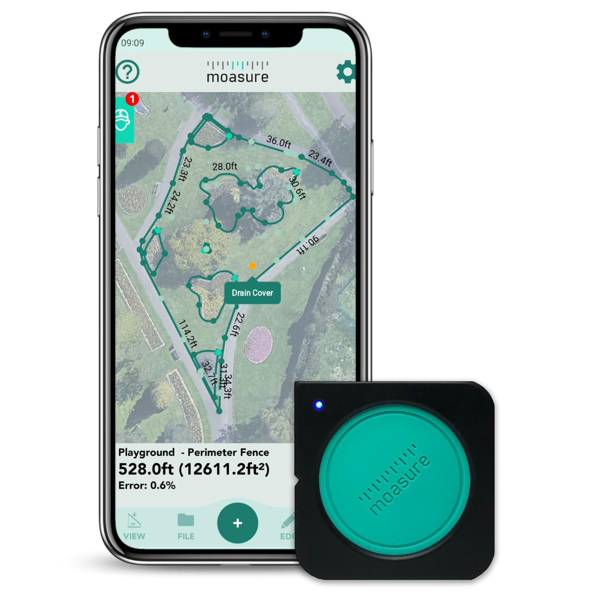
Measure curved shapes & areas
At last, rapidly measure up curved lawns, pools or any free-form curved line. Moasure’s game-changing technology allows you to simply trace along a curved line using Moasure ONE to digitally and automatically calculate the area and perimeter or irregular shapes and spaces like driveways or yards.
Once the measurement is complete, you can view a detailed drawing of the shape, in 2D or 3D, on your smartphone or tablet.
Measure multiple areas in one
Measure multiple shapes relative to each other – all in one, single measurement.
This new and powerful feature, called Layers, enables you to measure shapes, or Layers, within an area and produce a comprehensive on-screen diagram of all Layers – all positioned relative to each other.
Measure around obstacles, without line of sight
Moasure ONE's advanced motion-measuring technology enables you to rapidly take measurements regardless of obstructions such as rising ground, large bushes or trees.
Simply moving around an obstacle and utilising Moasure's Ignore Point feature displays a complete measurement as if the obstacle was never there.
NEW Measure 3D Terrain & Calculate Volume
Moasure ONE enables you to rapidly capture a 3D terrain map of your site, and instantly visualize it, using the new contour view. Switch from a 2D contour view to a 3D terrain map and see the 3D true surface area.
You can also effortlessly calculate the Cut & Fill, making calculating drainage projects more efficient and profitable. Whilst the ‘Add Depth’ tool allows you to add custom depth and calculate the required volume of material for a site.

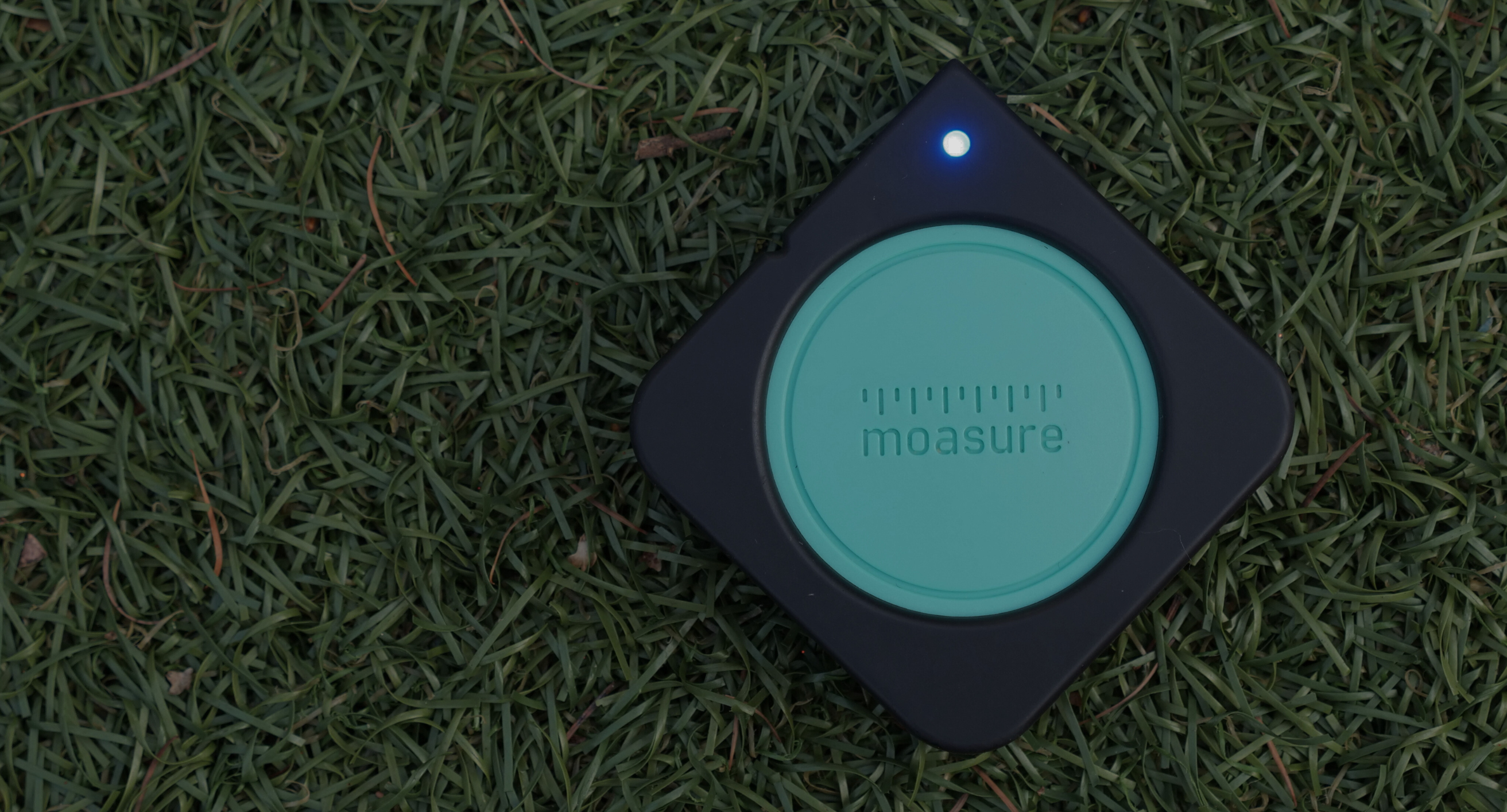
How Moasure works
It really is rocket science.
Moasure uses the same technology that is used in rocket guidance systems to keep track of the rocket’s movement in space.
Moasure is completely self contained - it doesn't rely on GPS, lasers or an internet signal to measure. Instead, Moasure uses inertial motion sensors - accelerometers and gyros - to measure its own movement. As the user moves the Moasure module, it calculates how far it is being moved and in which direction it is moving; it does this hundreds of times each second.
Moasure works equally well in bright sunshine or complete darkness - it'll work underground in a cave, if that's where you want to measure!


Export Measurement Drawings & Data
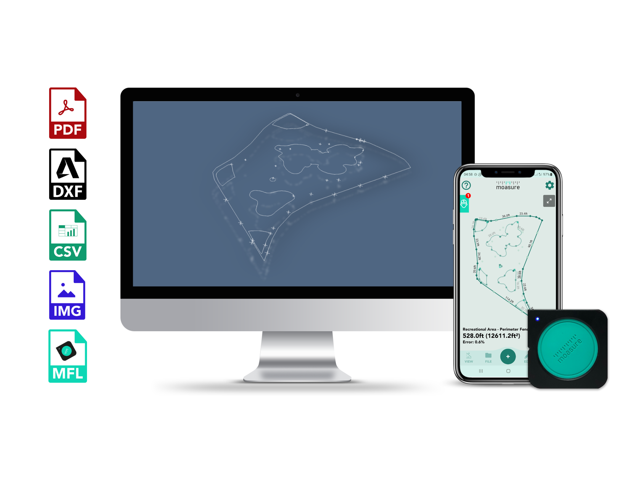
Export to PDF - Automatically generate a comprehensive PDF document of your measurement, including a diagram of the measured shape and corresponding measurements for each edge, as well as elevation data for each captured point.
PDFs are scaled - choose from ‘Scale to Fit’ or select a custom scale ranging from a precise 1:1 ratio all the way up to 1:500. PDFs include a full-page grid, a scale bar, and clearer dimensions and labels to bring your measurements to life with clarity and precision. Moasure supports a wide range of paper size options, including A0 to A4, as well as engineering paper sizes such as ANSI C to E.
Export to DXF (AutoCAD/DWG Compatible) - Export 2D or 3D DXF files, which can be opened in all popular CAD applications such as AutoCAD, SketchUp, VectorWorks and ArcSite.
Export to CSV - Export coordinate data as a CSV file. CSV files can be used for many CAD applications. The CSV file displays the measurements X, Y and Z values.
Take full control over how your measurements are exported in CSV format with our fully configurable settings. You can select the exact data you need to export, letting you decide which measurement data you are exporting.
Export to Image - You can also export your measurements in image formats including PNG, JPG and as transparent SVG.
Real Stories from Experts
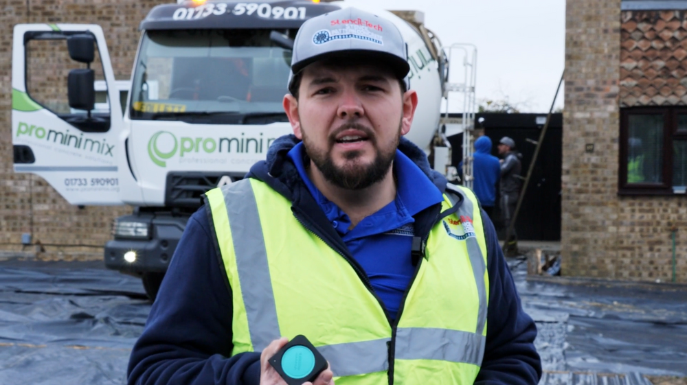
Fred Adams
Stencil-Tech Concrete
Scott Baker
Tidybricks Landscaping

Mat Baroudi
An English Gardener Landscaping

John Towne
Mowtowne Landscaping

30-Day Satisfaction Guarantee
If you're not satisfied, we're not satisfied. If you would like to return your Moasure ONE, simply keep your original product packaging and accessories and ensure the device is in sellable condition (we know you have to use it). Get in touch with us to return the product within 30 days from purchase.
A measuring tool like no other
Save time, money, and hassle with this first-of-its-kind device that draws & measures simultaneously and fits right in the palm of your hand.
- Choosing a selection results in a full page refresh.
- Opens in a new window.